Hakone Myojingatake Hike - from Saijoji to Miyagino
On Sunday 3 Sept 2023, I did a 6hr solo point-to-point hike in Hakone, ascending 903m up to Myojingatake (明神が岳, 1169m) from Daiyuzan Saijoji Temple (大雄山最乗寺 aka Doryoson), and descending 719m to Miyagino (宮城野) on Rt. 138, traveling over about 9km. From there I took the bus down to Kami-to-no-sawa (上塔ノ沢), then walked to an onsen for a scrub and a soak.
When I hiked up Myojogatake, I had intended to go up Myojingatake as well, but I was tired that day and opted out. In looking at various routes up today’s peak, I picked the route coming from the northeast, from the lovely and sprawling temple complex at Saijoji.
As usual, I wanted to start out early to be off the mountain around noon, so I left at 4:30am, got to Odawara before 6:00am, and was at Daiyuzan station, the last stop on the Izu Hakone Tetsudo line, by about 6:20am. To my surprise, the buses up to Saijoji start around 9am, so, I used the public toilet outside the station, then checked the map for how far it would be to walk to Saijoji (about 3km). Fortunately a taxi pulled in, so I took advantage and got a ride up the road. The taxi driver was talkative, regaling me with his own hiking adventures, but we arrived within 15 min.
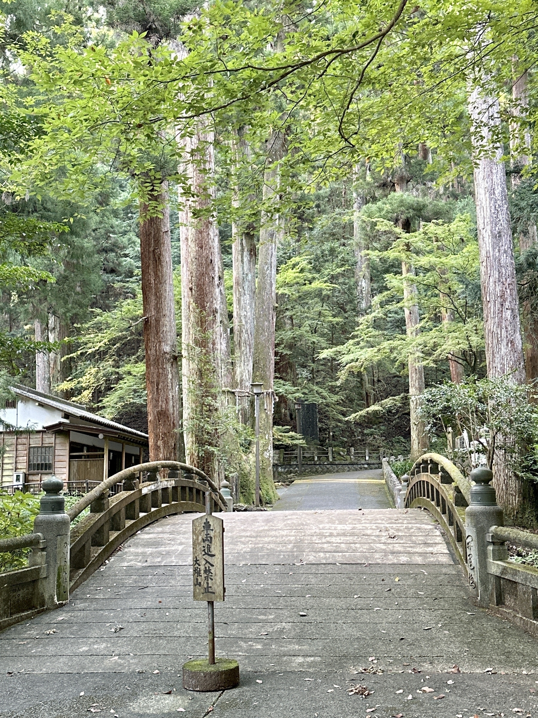
There’s two more-or-less parallel routes up Myojingatake, both proceeding in the southwest direction from Saijoji. One starts at the Saijoji entrance, off to the left immediately; the other from the back of the complex, after you pass through it. I chose to go through the temple complex and take the more north of the two routes. It was a bit tougher to find the actual trail, but Yamareco kept me on track.
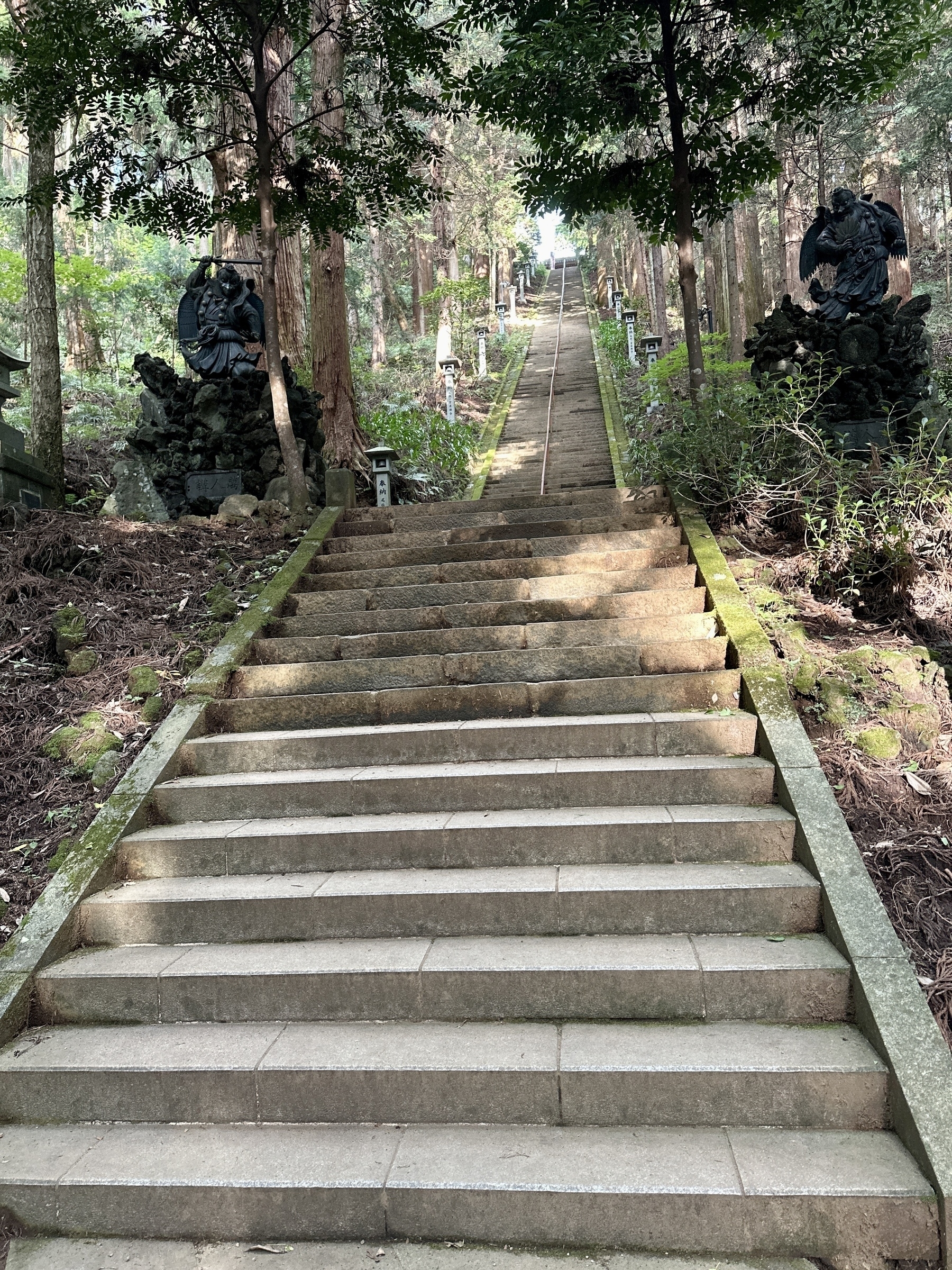
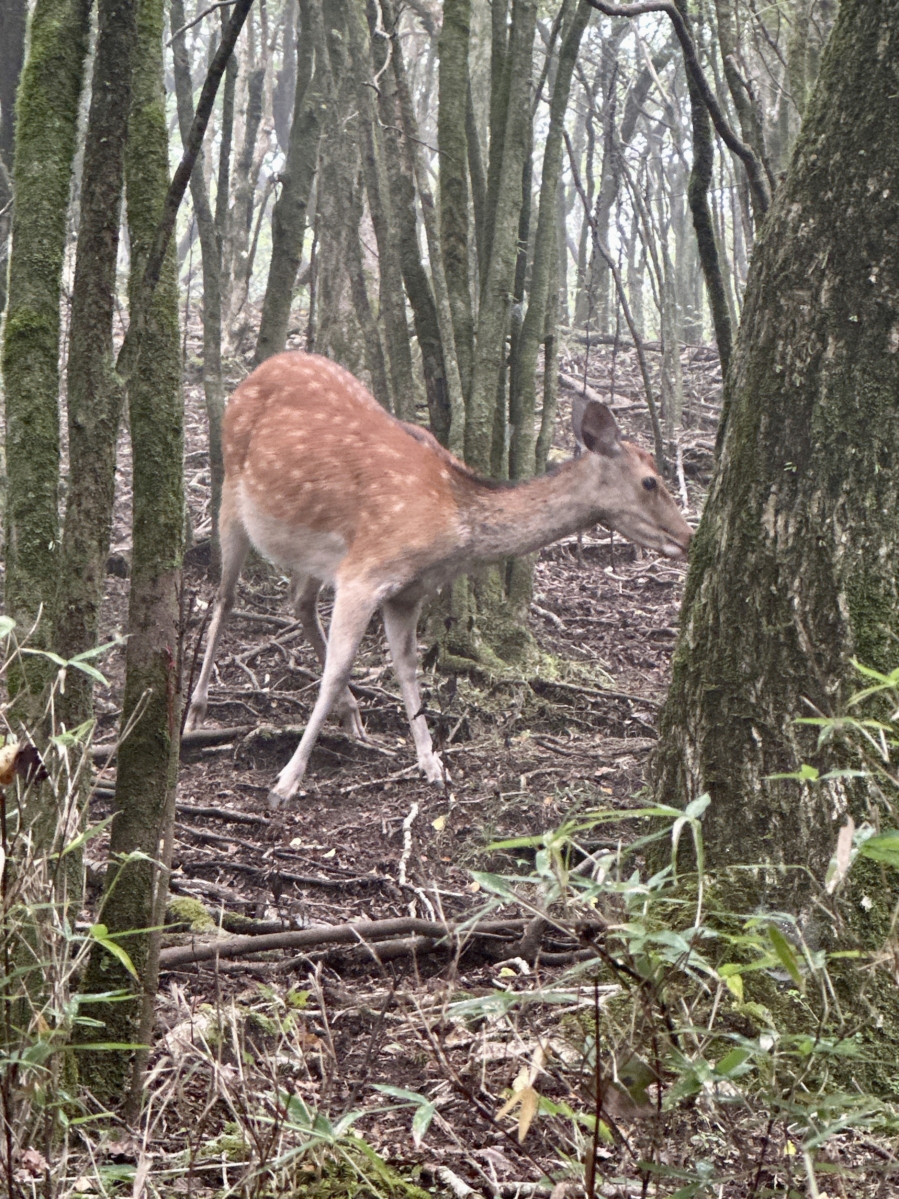
The temple complex is really beautiful, but there are so many steps. I counted about 220 or 230 steps on only the last staircase. There were plenty more before that. After you get on the trail, it’s a cedar forest for most of the way to the top along a ridgeline. The trail is packed dirt with some rocks and roots. It was misty in the early morning, and as I was marveling at the view in one spot, I heard a rustle, and turned to find a doe about 3 meters away. She regarded me, and I regarded her, as I took some snaps and a quick video, then she ran off just as soon as she had come into view. That, and the fog made the hike feel quite magical.
A couple of spots during the ascent are not well marked. I mistakenly headed up a river bed at one, but realized something was off, doubled back, and went up a steeper route to the left which turned out to be right. Another spot was just open forest area where you could barely see the trail. In either case, it helped to look at the Yamareco app, which has a clear indicator of which direction you should be proceeding, and even lets you know if you veer off.
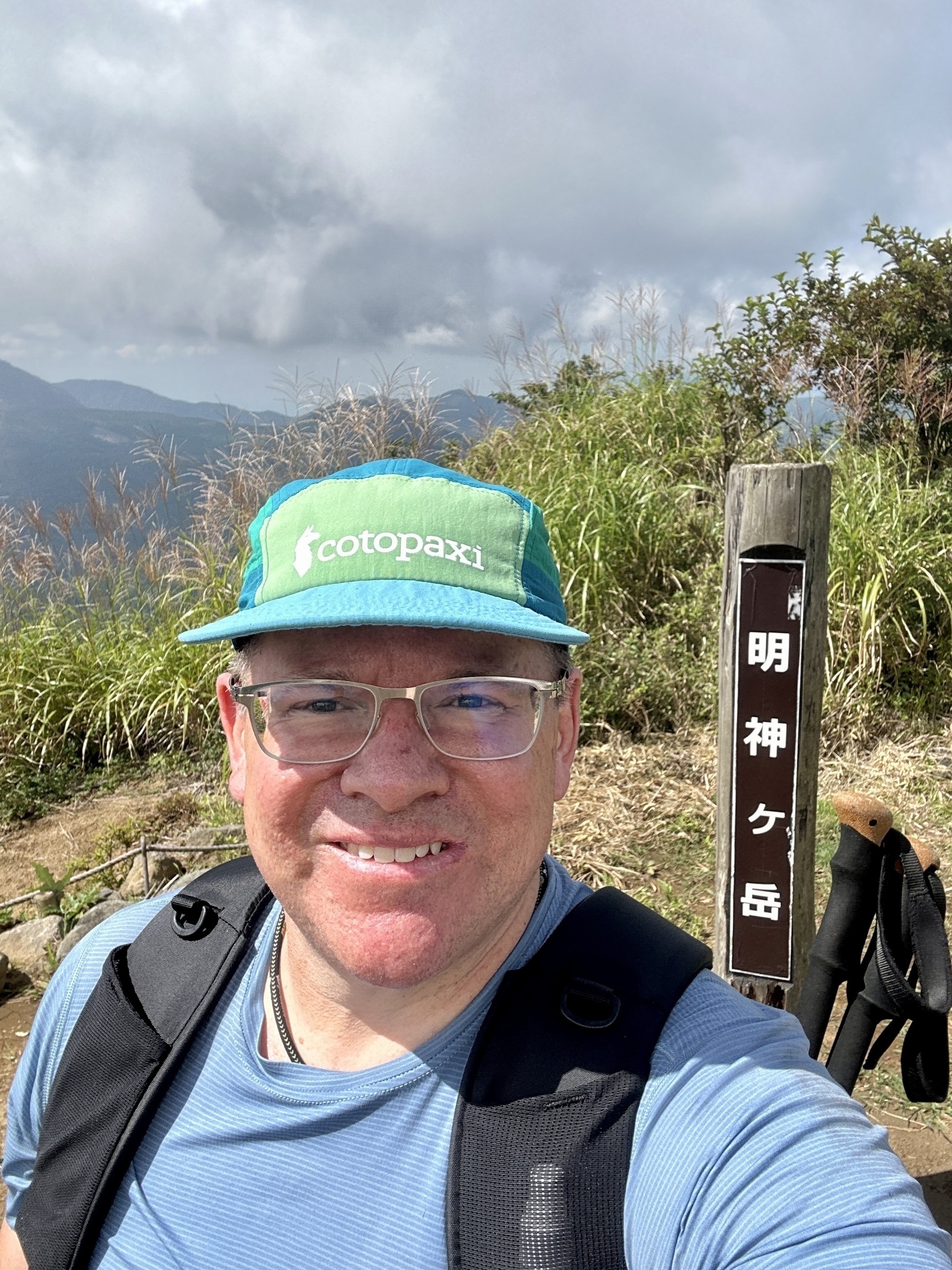
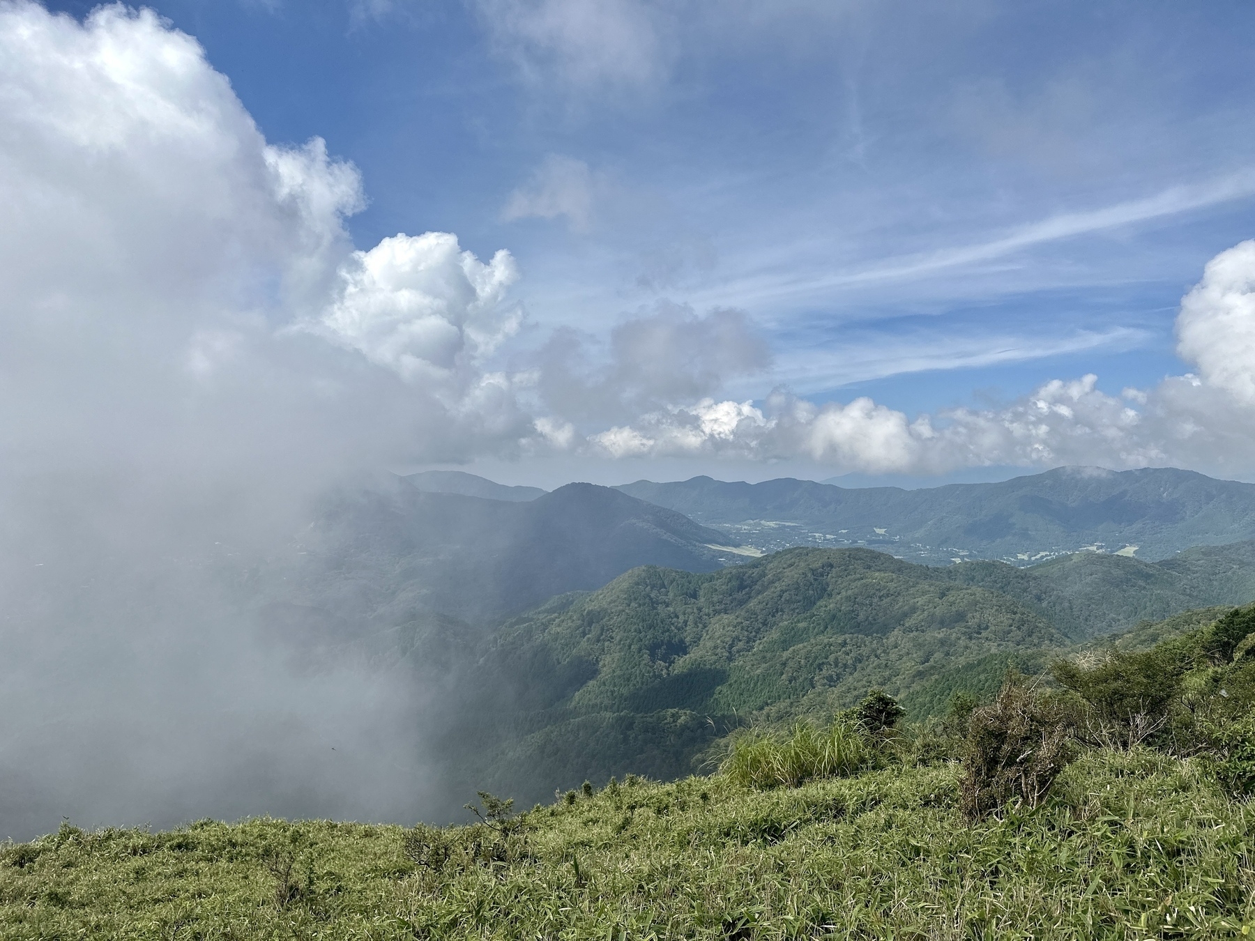
After the long ascent, I got to what was marked as the summit on the map, but there was no placard or any kind of sign that I was in the right place, so I got a bit worried I was off track. I kept going though, and finally got to a kind of picnic area a few meters below, which had signs and explanations of what should be visible. I didn’t have luck seeing Mt. Fuji again, but I could at least see Mt. Kintoki in the foreground (Fuji should have been visible behind it).
I took a short break at the picnic tables, then started descending, eventually merging with the same route as I took when I hiked Myojogatake a few weeks before. As I mentioned in that post, you see signs for the Miyagino Annaijo bus stop and toilet as you get close to the road. I waited a few minutes for a bus bound for Hakone Yumoto, headed down about 15 min or so, then got off at Kami-Tonosawa bus stop. From there I walked a little bit up to Hakone Yuryo, my oft-frequented day-spa onsen for a post-hike soak and a meal.
Hakone Yuryo runs a shuttle bus to and from Hakone Yumoto station, so I took advantage of that to get to Hakone Yumoto afterwards, then took the funicular to Odawara and took the JR train back home.
A couple days after this hike, a retired police and experienced hiker friend told me they used Myojingatake for mountain training when he was in the police academy. He said that a respected older officer suddenly fell dead when they were on a training hike there one day, and that he has never forgotten that incident, burned into his young brain at the time. That was a bit chilling to hear, but it just reminds you that you need to be prepared and ready for anything in the mountains.
As always, please check out the route map on my Yamareco activity URL, and I hope to see you on the trail some time! 🌋
Here’s my assessment of this hike using the Japan Mountain Hike Grading scales:
| Ranking Criteria | Details | Level |
|---|---|---|
| Stamina | (6×1.8) + (9×0.3) + (0.9×10) + (0.7×0.6) = 23 | 3 |
| Technical Difficulty | Path sometimes hard to follow, Some plunge/slip risk areas | B |
See the photo galleryand Yamareco activity record.
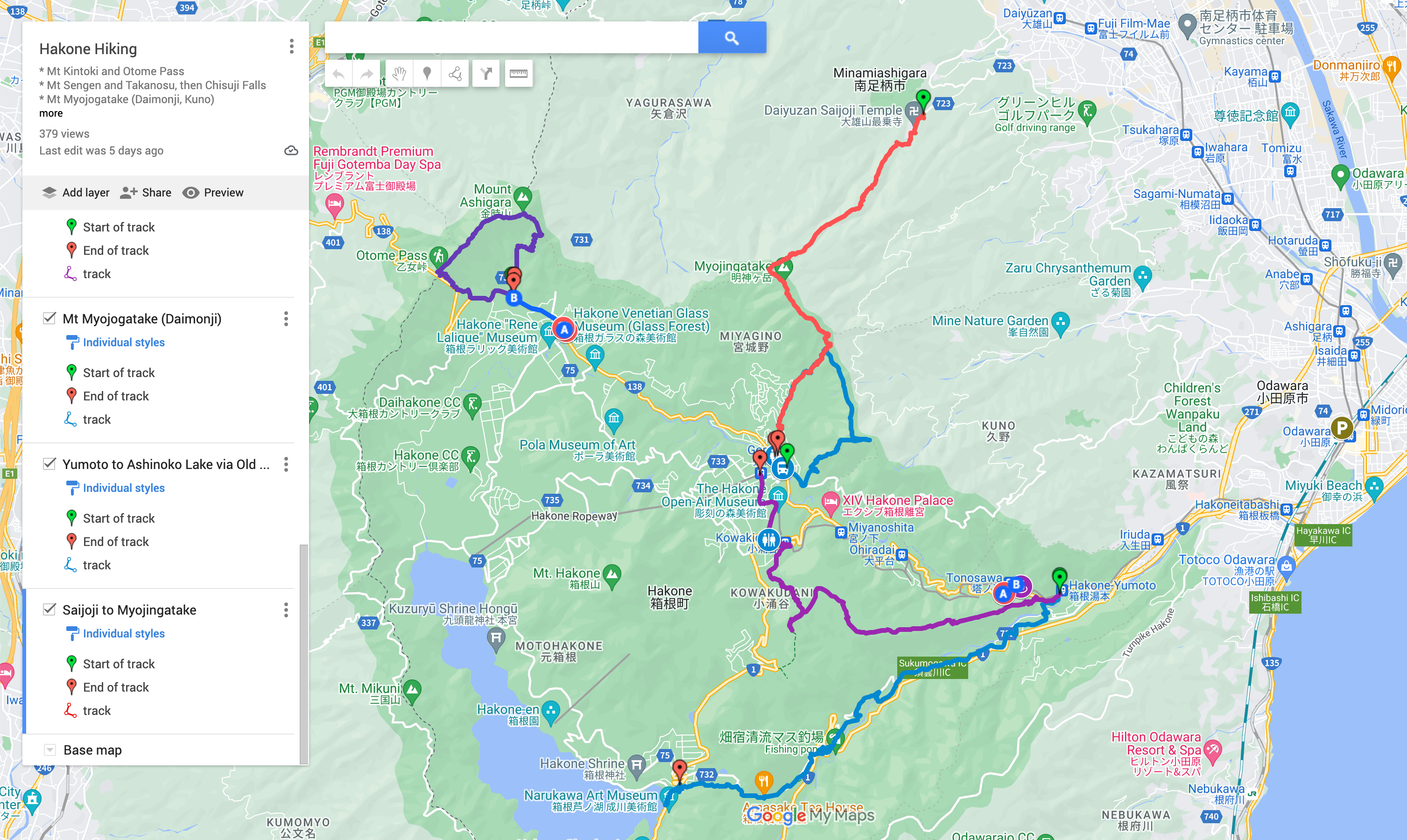
Route map, see also on Google Maps:
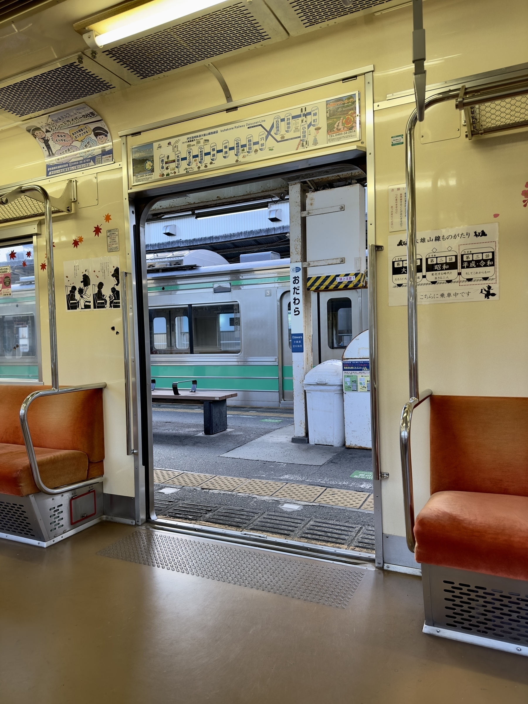
Izu Hakone Tetsudo Line Train, at Odawara:
Bridge just inside Saijoji, heading to the trailhead I didn’t use:
Comically long staircase at Saijoji:
Doe friend on the trail:
At the summit: